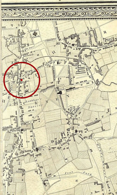
Below is a map from 1827. The whole area at the time was fields and villages, and Mare Street itself was lined with the expensive abodes of former traders. I’ve marked an approximate spot for Valette on it.
And here’s one from 1868. In less than a lifetime, the area had become an urban outrider of the city proper with large buildings, a road network, schools and multitudinous alms houses. The speed of growth must have been mindblowing to the rural population who were seeing this grow up around them. At this time it was still technically part of Middlesex but was fast being swallowed, and Hackney was formally annexed by London in 1899.

One noteable thing about the second map is that Jerusalem Square, later replaced by Valette House and Street, is characterised as being part of a slum, later being knocked down to widen the road. At the time a large rise in population saw lots of people being pushed into these areas, where they jerry-built housing and upset the well-to-do types on Mare Street.
This is well illustrated because handily, just five years before demolition work started in Valette Street, Charles Booth finished his infamous map of poverty in London (searchable here). Blue represents a high poverty level, red for the middle class.

Enclosed slum squares, very densely populated (around 500 people were squeezed into the space when it was earmarked for demolition) were known as rookeries at the time, and constantly bashed for their alleged lawlessness. So Valette, along with being social housing with proper sanitation, appears to have been part of an attempt to impose some order on those unruly poor folk.


